


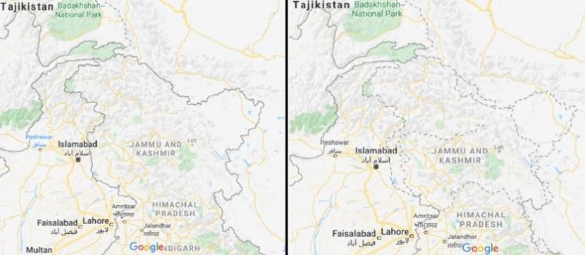
Google Maps shows Kashmir's outlines as a dotted line acknowledging "dispute" when it is seen from outside India as the search engine redraws the world's borders based on where the user is viewing them from. When Jammu and Kashmir is searched from India on Google Maps, it displays a solid grey outline bordering the region and showing it as part of the country. Google Maps say, "disputed boundaries are displayed as a dashed gray line. The places involved don't agree on a boundary." "We remain neutral...and make efforts to objectively display the dispute using a dashed line," a Google Maps official said.
Google Maps shows Kashmir's outlines as a dotted line acknowledging "dispute" when it is seen from outside India as the search engine redraws the world's borders based on where the user is viewing them from. When Jammu and Kashmir is searched from India on Google Maps, it displays a solid grey outline bordering the region and showing it as part of the country. Google Maps say, "disputed boundaries are displayed as a dashed gray line. The places involved don't agree on a boundary." "We remain neutral...and make efforts to objectively display the dispute using a dashed line," a Google Maps official said.

174.jpeg)
113.jpeg)
148.jpeg)
79.jpeg)
69.jpeg)
19.jpeg)
5.jpeg)